2026 — GISVIEW MAP →
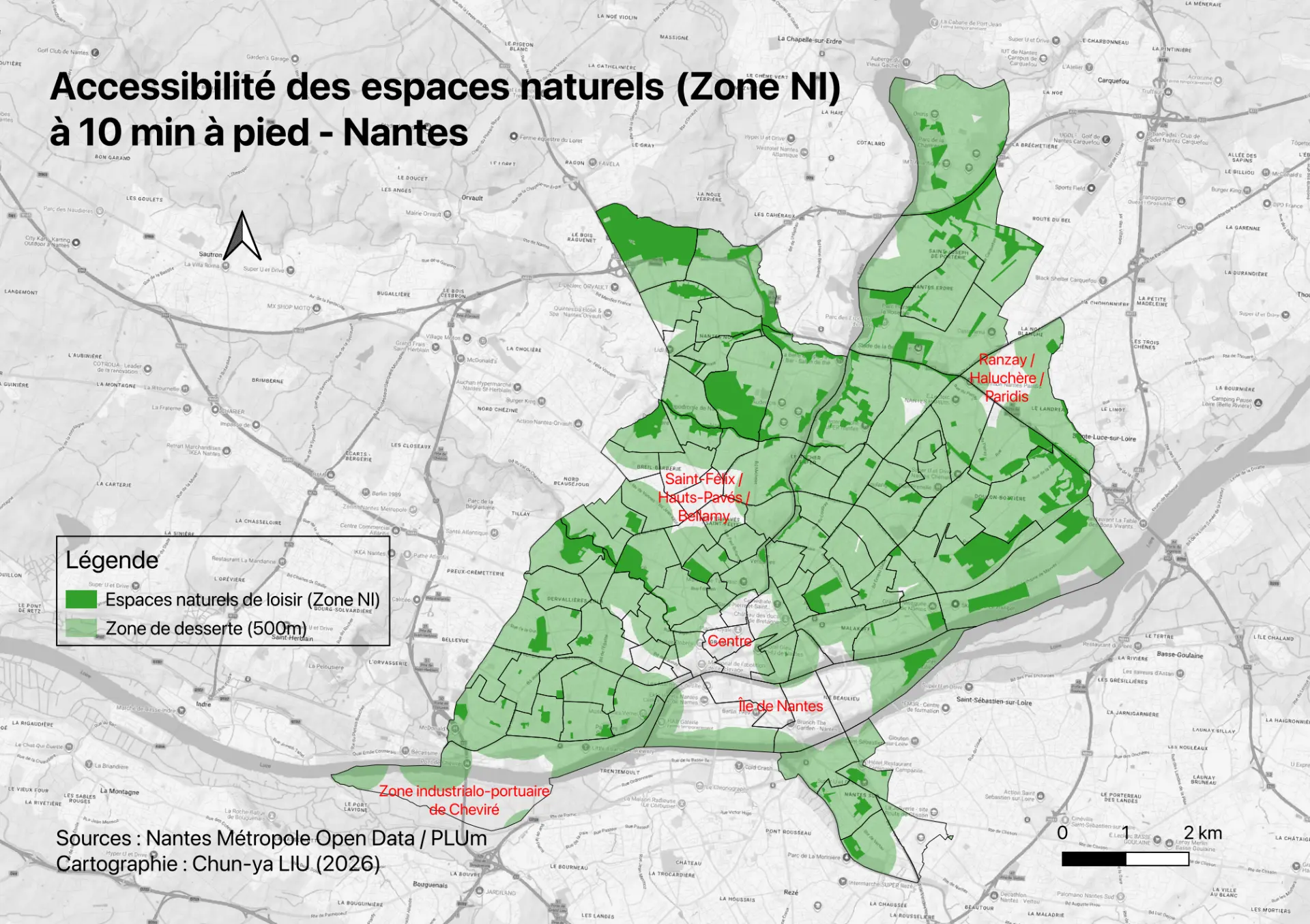
Accessibility of Recreational Green Spaces in Nantes: The 10-Minute Walking City and Its Blind Spots
Can Nantes residents reach a public leisure green space within a 10-minute walk? Mapping coverage and four kinds of blind spot.
( 01 ) — SPATIAL NARRATIVE
Distilling the complex weave of population, land, and spatial movement into clear, simple stories and maps to inform decision-making.
( 02 ) — SELECTED WORK
Can Nantes residents reach a public leisure green space within a 10-minute walk? Mapping coverage and four kinds of blind spot.
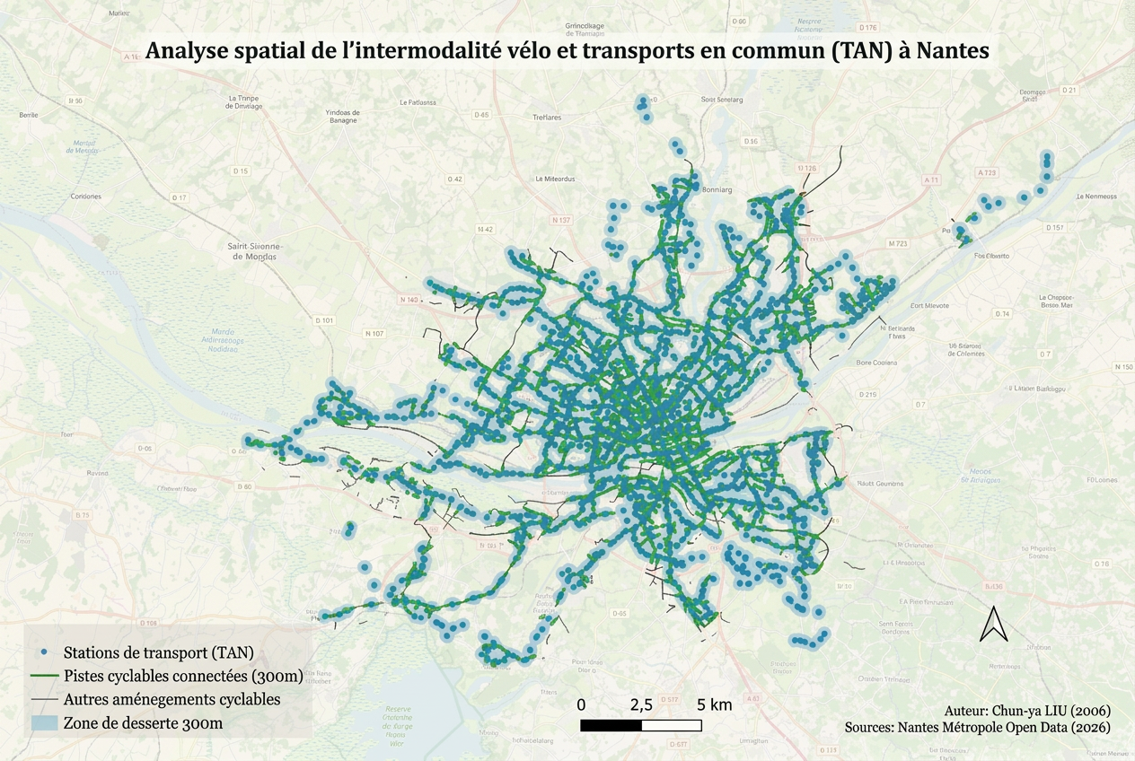
300-metre interchange coverage between cycle routes and TAN stops across Nantes Métropole.
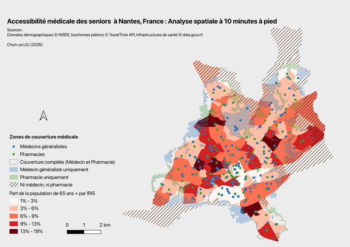
Doctors, pharmacies and older residents within a 10-minute walk.
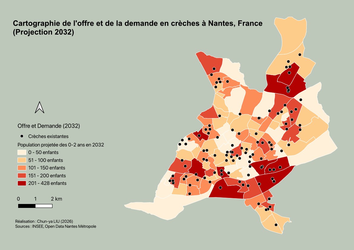
Spatial gaps between existing crèches and projected demand among children aged 0–2.
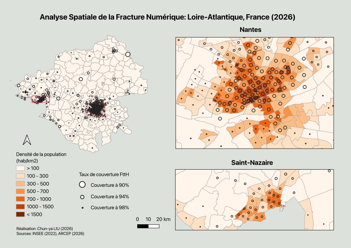
Fibre coverage × population density in Loire-Atlantique.
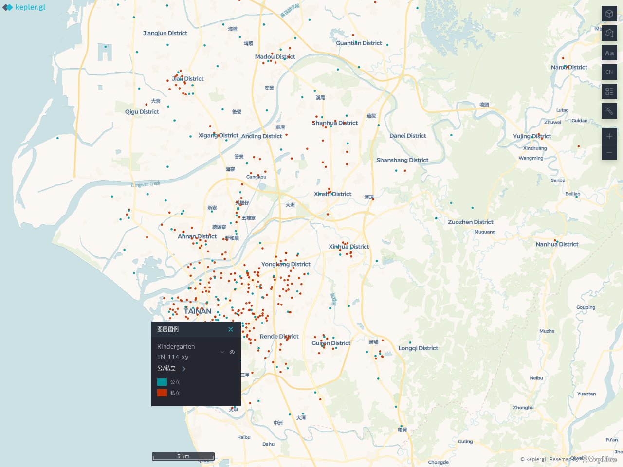
An interactive map of public and private kindergartens across Tainan, with locations and contact details.
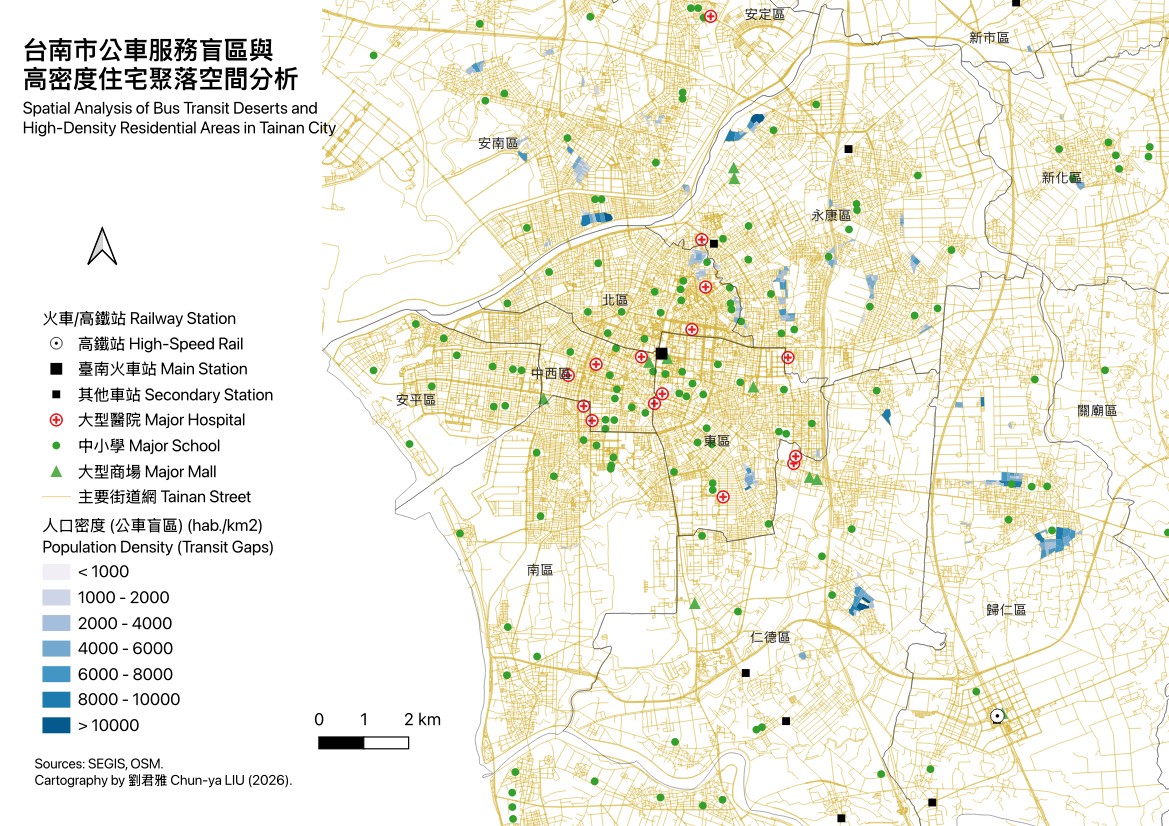
Locating high-density residential neighbourhoods left beyond the reach of the existing bus network.
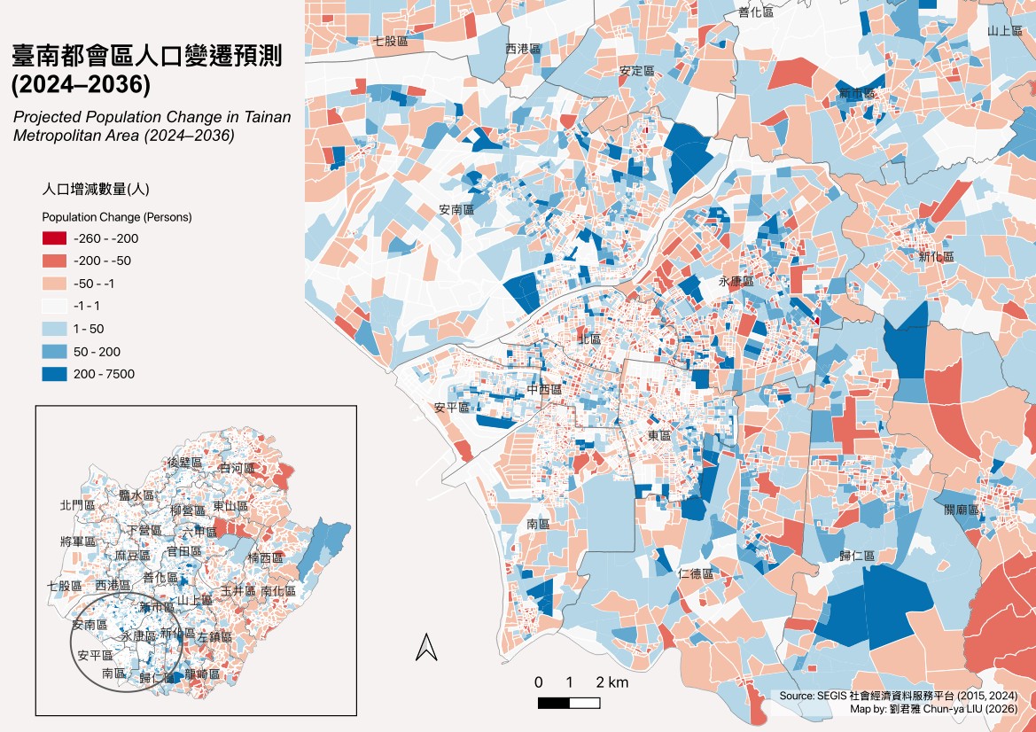
A shrinking old city and a polarising new one: where Tainan loses and gains residents.
( 03 ) — PROFILE
SOCIO-ECONOMIC STUDIES & GIS SPECIALIST
From Tainan, Taiwan, and living in France for over 15 years, with a PhD in land planning, masters in demography and geography, as well as in national development. I specialise in online platform building and database management, cartographic analysis, AI spatial model training and GIS technical training — and I am dedicated to applying spatial-analysis methods in socio-economic research.
LANGUAGES
EXPERIENCE
Geospatial AI & LLM Alignment (RLHF): Evaluated, fine-tuned, and benchmarked generative AI and frontier models, with a specialized focus on spatial reasoning, geostatistics, and GIS workflows.
Built and ran Cart'âge, an online mapping platform and territorial database on ageing — grown from nothing to 2,200+ indicators. Trained 50+ public-sector users and published regular regional demographic analyses.
cart-age.gerontopole-paysdelaloire.fr ↗Taught simplified Chinese to French university students, 200 hours per year.
Research on Taiwan's urban development: political regimes, economic development and urban growth. PhD thesis in Geography, supervised by Natacha Aveline — Université Paris 1 Panthéon-Sorbonne, 2020.
theses.fr/2020PA01H015 ↗EDUCATION
PhD, Land PlanningUniversité Paris 1 Panthéon-Sorbonne
2014–2020M2 GeographyUniversité Paris Cité
2012–2013M2 DemographyUniversité Paris Cité
2011–2012MA National DevelopmentNational Taiwan University
2005–2008BA Public AdministrationNational Chi Nan University
2002–2005Associate Degree in FrenchWenzao Ursuline University of Languages
1997–2002TECHNICAL SKILLS
GIS TOOLS
DATABASE
STATISTICS
DATA / WEB VISUALISATION
PUBLICATIONS